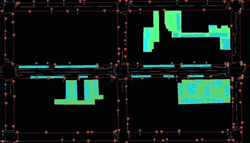
Autonomous vehicles require a variety of sensors to perceive their surroundings. However, vehicles’ sensors alone can’t be relied on to ensure safety. More is needed in the form of High Definition Maps.
High Definition Maps contain more detail than traditional maps, such as the exact location of every traffic device, lane line, curbside and traffic light, with accuracy to the sub-meter or even centimeter level. HD maps are also able to interpret traffic regulations, such as speed limits and parking rules. Thus, autonomous vehicles can rely on HD Maps to detect their locations and determine the optimal route even when sensors fail.
Many companies employ specialized vehicles to do HD mapping, however, this method can be expensive. In addition, the consumption of time from data collection to processing can make it even harder to scale large areas efficiently.
PolaGIS, a startup founded in Boston, aims to address these issues. By employing deep learning and computer vision, PolaGIS collects map data from street-level images such as lane lines, traffic signs, traffic lights, road borders etc. to not only pinpoint their locations but at the same time, extract their content and attributes, effectively and efficiently.

PolaGIS separates map data into three broad categories:
1. Road Markings and Attributes
PolaGIS is able to extract key road features, such as lane markings, lane lines, symbols, on-street, and off-street parking space, and etc. Also, the key attributes such as lane width, pavement color, lane types etc. can be obtained as well.
2. Traffic Signs
PolaGIS uses deep learning to extract text and image information on the signs. The information is analyzed and categorized into various types, such as regulatory, warning, and guidance, and can be used to interpret parking price and rules.
3. Other Road Devices
In order to help vehicles making more reliable decisions, PolaGIS also provides exact locations of other devices such as traffic lights, parking meters, fire hydrants, traffic barriers, etc.
Currently, PolaGIS is able to collect a large amount of data in a short period of time, which can serve to expedite the development of HD maps. The types of data do not pertain only to highways; traffic data on a city, state, or an entire country can be obtained in this manner. In the near future, crowdsourcing will be employed to help facilitate the collection of newer and more accurate map data. Such live, real-time data will be incorporated to HD maps to provide for a more dynamic platform.
About PolaGIS Inc.

Headquartered in Boston, Massachusetts, PolaGIS specializes in collecting and providing map data with high accuracy and efficiency. Utilizing deep learning and computer vision, we are able to extract map features from satellite and street-level imagery, informing the development of innovative maps for smart parking and geospatial services for the automotive vehicle industry.


